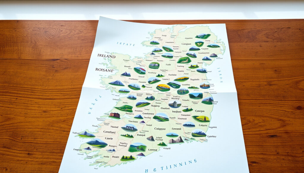
County Map of Ireland: 32 Counties by Size, Safety & Scenery
Few things capture the spirit of Ireland quite like its county map. Whether you’re tracing ancestors, planning a road trip, or simply curious about the Emerald Isle, those 32 distinct shapes tell a story of history, landscape, and identity.
Total counties in Ireland: 32 ·
Counties in the Republic of Ireland: 26 ·
Counties in Northern Ireland: 6 ·
Smallest county by land area: County Louth (820 km²) ·
Largest county by land area: County Cork (7,457 km²)
Quick snapshot
- Ireland has 32 counties across the island (Wesley Johnston geography resource)
- County Louth is the smallest county at 820 km² (Irish Genealogy Toolkit county guide)
- County Cork is the largest county at 7,457 km² (World Atlas Ireland mapping)
- Which county is the prettiest is subjective and varies by survey
- The safest county ranking depends on the type of crime measured
- The poorest county may differ based on metric (income vs. deprivation)
- County Dublin was abolished as a distinct administrative entity in 1994 (Wikipedia counties of Ireland)
- Three new administrative counties replaced the former County Dublin functions (Wikipedia counties of Ireland)
- Downloadable and printable county maps remain in high demand for genealogy and travel planning (World Map Blank labeled map)
Five key facts about Ireland’s counties, one pattern: the island’s 32 counties range dramatically in size, population, and character, with the smallest being roughly 11 times smaller than the largest.
This data table shows the island’s core geographical benchmarks.
| Metric | Value | Source |
|---|---|---|
| Total area of Ireland | 84,421 km² (32,595 sq mi) | World Atlas Ireland mapping |
| Number of provinces | 4 | Greenway Hub county guide |
| Most populous county | Dublin (1.4 million) | World Atlas Ireland mapping |
| Least populous county | Leitrim (32,000) | Irish Genealogy Toolkit county guide |
| Highest point | Carrauntoohil (1,038 m) in County Kerry | World Atlas Ireland mapping |
The pattern: Dublin dominates population while Leitrim anchors the sparsely populated northwest, a divide that recurs across economic and safety rankings.
What is the prettiest county in Ireland?
What is the most beautiful county in Ireland?
- County Kerry is frequently cited as the prettiest due to the Ring of Kerry and Killarney National Park (Irish Genealogy Toolkit county guide).
- County Clare and County Galway also rank high for natural beauty, with the Cliffs of Moher and Connemara drawing visitors from around the world.
- Travel surveys from Lonely Planet travel authority and Condé Nast consistently place these counties at the top for scenic landscapes.
Which counties are often ranked as the most scenic?
- The Ring of Kerry in County Kerry, the Burren in County Clare, and the Aran Islands off County Galway are three of the most photographed locations in Ireland.
- County Donegal, with its rugged coastline and Slieve League cliffs, is also a strong contender in beauty rankings.
County Kerry alone draws more than 1 million visitors annually to the Ring of Kerry—a stretch of road that packs more jaw-dropping views per mile than almost any other county in Ireland. If you have only three days, Kerry is the bet.
What is the poorest county in Ireland?
What is the poshest part of Ireland?
- According to Central Statistics Office Ireland national statistical authority, County Donegal has the lowest disposable income per capita.
- County Leitrim also ranks low in economic indicators, with a population of roughly 32,000 and limited industrial base.
- The poshest area is often considered County Dublin (Dún Laoghaire-Rathdown) or parts of County Wicklow, where median incomes are significantly higher.
What is the most forgotten county in Ireland?
- County Leitrim is frequently described as the most overlooked county, with the smallest population of any county in the Republic of Ireland.
- County Longford and County Roscommon also appear on lists of counties that receive fewer visitors and less economic investment.
Lower-income counties like Donegal and Leitrim offer the lowest crime rates and some of the most stunning natural landscapes in Ireland. Residents trade earning power for quality of life and safety—a choice that shows up in every cost-of-living comparison.
What are the 32 counties in Ireland in order?
What are the four provinces of Ireland?
- The four provinces of Ireland are Connacht, Leinster, Munster, and Ulster (Greenway Hub provincial guide).
- Leinster has 12 counties, Munster has 6, Connacht has 5, and Ulster has 9 (Greenway Hub provincial guide).
- Ulster is the only province that spans two jurisdictions: six of its nine counties are in Northern Ireland, and three are in the Republic of Ireland (Greenway Hub provincial guide).
Which counties are in Northern Ireland?
- Northern Ireland comprises 6 counties: Antrim, Armagh, Derry, Down, Fermanagh, and Tyrone (Irish Genealogy Toolkit county guide).
- The 26 counties of the Republic of Ireland are Carlow, Cavan, Clare, Cork, Donegal, Dublin, Galway, Kerry, Kildare, Kilkenny, Laois, Leitrim, Limerick, Longford, Louth, Mayo, Meath, Monaghan, Offaly, Roscommon, Sligo, Tipperary, Waterford, Westmeath, Wexford, and Wicklow (Irish Genealogy Toolkit county guide).
Six counties in Northern Ireland, 26 in the Republic—one pattern: the 32-county system remains the standard map view even though modern administrative boundaries have shifted.
This province table shows the breakdown at a glance.
| Province | Number of counties | Counties |
|---|---|---|
| Connacht | 5 | Galway, Leitrim, Mayo, Roscommon, Sligo |
| Leinster | 12 | Carlow, Dublin, Kildare, Kilkenny, Laois, Longford, Louth, Meath, Offaly, Westmeath, Wexford, Wicklow |
| Munster | 6 | Clare, Cork, Kerry, Limerick, Tipperary, Waterford |
| Ulster | 9 | Antrim, Armagh, Cavan, Derry, Donegal, Down, Fermanagh, Monaghan, Tyrone |
The implication: Ulster is the only province split across two jurisdictions, which means any county map of Ireland that shows all 32 counties needs to straddle both the Republic of Ireland and Northern Ireland boundaries.
What is the smallest county in Ireland by land?
What is the largest county in Ireland?
- County Louth is the smallest at 820 km² (Irish Genealogy Toolkit county guide).
- County Cork is the largest at 7,457 km² (World Atlas Ireland mapping).
- Other small counties include County Carlow (896 km²) and County Leitrim (1,590 km²) (Irish Genealogy Toolkit county guide).
How does county size vary?
- County Cork is roughly 9 times larger than County Louth.
- The five largest counties by area are Cork, Galway, Mayo, Donegal, and Kerry.
- The five smallest are Louth, Carlow, Leitrim, Monaghan, and Sligo.
Which is the safest county in Ireland?
What are the crime rates in Irish counties?
- According to CSO crime statistics Ireland’s official data authority, County Leitrim and County Roscommon consistently report the lowest crime rates.
- County Mayo and County Sligo also rank highly for safety, with low rates of burglary and public order offenses.
- Urban areas like Dublin and Cork have higher crime rates—particularly in theft and anti-social behavior categories—but are still generally safe by international standards.
Are there any counties with particularly low crime?
- Leitrim and Roscommon routinely appear at the top of safety rankings, with annual crime rates well below the national average.
- Rural counties in the west and northwest tend to have the lowest crime figures, while urbanized counties in the east and south report higher numbers.
Safety rankings depend heavily on which crime category you prioritize. Leitrim leads on low burglary rates, but Dublin’s city center has a higher concentration of pickpocketing and theft. The safest county for one person may not be the safest for another—check the specific crime type that matters to you.
“County Donegal has the lowest disposable income per capita of any county in the Republic of Ireland, according to our latest regional income analysis.”
Central Statistics Office Ireland national statistical authority
“The Ring of Kerry and Killarney National Park make County Kerry one of the most beautiful places on the planet, drawing visitors from every continent.”
Lonely Planet travel authority
“County Leitrim and County Roscommon consistently report the lowest crime rates in Ireland, making them the safest counties to live in.”
CSO Crime Statistics Ireland’s official data authority
The pattern across all three rankings—beauty, income, and safety—is that Ireland’s western and northern counties dominate the top of both the prettiest and safest lists, while also appearing at the lower end of the income scale. For anyone choosing where to visit or settle in Ireland, the trade-off between scenery and income is the central decision.
Frequently asked questions
How many counties are in Ireland?
There are 32 counties on the island of Ireland: 26 in the Republic of Ireland and 6 in Northern Ireland (Wesley Johnston geography resource).
What is the largest county in Ireland?
County Cork is the largest county by land area at 7,457 km² (World Atlas Ireland mapping).
How can I memorize the 32 counties of Ireland?
One common method is to learn them by province: Connacht (5), Leinster (12), Munster (6), and Ulster (9). Mnemonic devices and online quiz games like GeoGuessr can also help.
What is the county map of Ireland used for?
County maps are widely used for genealogy research, travel planning, educational purposes, and understanding local government boundaries. Many genealogy websites rely on the 32-county map for tracing Irish ancestry (Irish Genealogy Toolkit county guide).
Are there any counties in Ireland that no longer exist?
County Dublin was abolished as a distinct administrative entity in 1994 and replaced by three new counties: Dún Laoghaire–Rathdown, Fingal, and South Dublin (Wikipedia counties of Ireland). However, Dublin is still recognized as a traditional county on most maps.
Which county is Dublin in?
Dublin is both a city and a traditional county. In modern administrative terms, the Dublin area is divided into four local government areas: Dublin City, Dún Laoghaire–Rathdown, Fingal, and South Dublin (World Map Blank labeled map).
What is the history of the county system in Ireland?
The county system in Ireland dates back to the Norman invasion in the 12th century, with the current 32-county structure largely established by the 17th century. The system was originally based on the shire model used in England and has evolved through various administrative reforms, most notably in 1994 when County Dublin was restructured.
More related posts
 Room to Rent Cork: Best Websites, Tips & Private Landlords
 Is There a Full Moon Tonight? Tonight’s Phase for Ireland
 Wild Mountain Thyme Lyrics: Scottish or Irish? Origin & Meaning
 Women’s Super League Games: Fixtures, TV & Live Results
 Paracetamol Dosage by Weight: Guide for Children & Adults
 River Lee Hotel Cork: Directions, Parking, Reviews & Guide
 Four Seasons Hotel Carlingford: Reviews, Prices & What to Expect
 Premier Inn Rest Easy: Reviews, Complaints & Legal Case