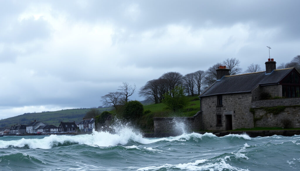
Storm Goretti Ireland Weather Warning: Latest Updates and Impact
If the first weather chat at the office this week involves the word “snow,” you’re not alone. Storm Goretti has officially arrived with a Status Yellow warning for parts of southern Ireland, and while it’s not the blockbuster some might expect, it’s worth knowing exactly what’s headed your way.
Storm Name: Storm Goretti ·
Warning Issued: 7 January 2026 ·
Warning Level: Status Yellow (snow-ice) ·
Affected Areas: Southern Ireland, Cork, Kerry, Waterford ·
Key Hazards: Snow above 250m, sleet, rain, icy surfaces
Quick snapshot
- Yellow warning issued by Met Éireann (The Irish Times (national newspaper))
- Valid from 7 January 2026 (The Irish Times (national newspaper))
- Snow-ice hazard for southern counties (The Irish Times (national newspaper))
- Cork, Kerry, Waterford most affected (RTÉ (national broadcaster))
- Snow above 250m elevation (RTÉ (national broadcaster))
- Coastal spot flooding possible (RTÉ (national broadcaster))
- Night of the Big Wind (1839) is the worst storm
- Storm Goretti is a moderate event by comparison
- No major damage expected
- No immediate follow-up storm forecast
- Flood risk by 2050 tied to climate change
- Check Met Éireann for updates
Here’s what Met Éireann’s forecasters are saying, where the worst effects will be, and how this storm stacks up against Ireland’s wildest weather on record.
Will Storm Goretti affect Ireland?
Met Éireann issued a Status Yellow snow-ice warning for Cork, Kerry, Waterford, and Wexford, valid from 12:00 to 20:00 on 8 January 2026. The warning covers heavy rain that could turn to sleet and snow, particularly on higher ground above 250 metres. The Irish Times (national newspaper) reported that conditions to the north would be drier, with only coastal showers affecting other areas.
How serious is Storm Goretti?
- Met Éireann described the system as “not really very significant” for Ireland, according to RTÉ (national broadcaster).
- Forecaster Linda Hughes said Storm Goretti was a very strong storm but too far southeast to cause major impacts in Ireland.
- The main hazards: hazardous driving, localised spot flooding, and poor visibility — as listed by RTÉ’s weather warning report.
- Waterford Council warned of dangerous road conditions, adding that even gritted roads may become icy.
Where will Storm Goretti hit the worst?
Rain and sleet fell across parts of the south coast on 8 January, with snow on higher ground and strong winds. RTÉ (national broadcaster) noted that the heaviest precipitation was concentrated over Cork, Kerry, and Waterford. A separate warning from the Met Office covered six counties in Northern Ireland: Antrim, Armagh, Down, Fermanagh, Tyrone, and Derry.
Southern households face the most disruption, but for most of Ireland, Storm Goretti passes through as a wet, windy Tuesday.
The implication: Storm Goretti’s multi-hazard punch — snow, rain, ice, and wind — is concentrated in a narrow band, leaving large parts of the country untouched. For residents of Cork and Kerry, the warning is genuine; for Dublin, it’s a damp, cold day with little drama.
Is Dublin going to get snow?
Snowfall is expected mainly at elevation, not in low-lying Dublin. Met Éireann meteorologist Ailís Hankinson told The Irish Times (national newspaper) that rainy conditions on Thursday evening did not accumulate, with very little sleet or snow reaching the ground. Temperatures across the capital range from 2°C to 6°C, dropping to -2°C overnight.
Will Ireland have snow next week?
Scattered showers are forecast for Atlantic and northern counties, with hail and a chance of isolated thunderstorms in some areas. Met Éireann said Ireland would see icy conditions on 9 January, with very cold conditions later in the day. However, no additional named storms are currently forecast after Storm Goretti. The Met Office (UK’s national weather service) noted that amber warnings were issued for the UK on 8 January, but Ireland’s yellow warning expired at 20:00 that day.
Dubliners hoping for a proper snow day will be disappointed — the city sits too low and too far east for the system’s moisture to reach as flakes. The real accumulation stays in the hills above 250 metres.
The catch: While the capital stays mostly rain-slicked, overnight temperatures below freezing mean black ice could surprise commuters on Friday morning. Met Éireann’s forecast for 9 January warns of very cold conditions, even where the snow didn’t fall.
Where in Ireland will be flooded by 2050?
Sea-level rise projections indicate that coastal flooding will affect low-lying areas across the country. Regions at elevated risk include Dublin Bay, Cork, Galway, and Wexford. Climate change increases both the frequency and intensity of storm surges, which compound existing flood risks.
Storm Goretti’s current warning does not directly relate to these 2050 projections. The yellow warning deals with immediate hazards — snow, ice, and localised spot flooding — not long-term sea-level trends. However, the system’s multi-hazard character (rain turning to snow, coastal flooding from storm surge) illustrates the type of event that may become more common as the climate warms.
The pattern: Today’s yellow warning is a short-term event; tomorrow’s flood risk is a structural problem. Neither cancels the importance of the other, but they operate on wildly different time scales.
What was the worst storm to ever hit Ireland?
The Night of the Big Wind, which struck on 6 January 1839, is widely considered the worst storm in Irish history. It caused widespread destruction, leveling thousands of homes and claiming hundreds of lives. Other notable storms include Hurricane Debbie (1961), which brought hurricane-force winds, and Storm Emma (2018), which combined with the “Beast from the East” to paralyse the country with snow.
Storm Goretti, by contrast, is a moderate event. Met Éireann’s own language — “not really very significant” — confirms that this system, while disruptive locally, doesn’t come close to the historical giants. The BBC News (international news service) noted that the system was named by Météo-France, the French meteorological service, and was more impactful over continental Europe than Ireland.
What is the worst natural disaster in Ireland?
The Great Famine (1845-1852) remains the deadliest natural disaster, but among purely meteorological events, the Night of the Big Wind (1839) stands as the benchmark for extreme storms. Storm Goretti is a reminder that even modest storms require preparation, especially on the roads.
Why this matters: Irish weather memory is long, and every named storm gets compared to the giants of the past. For practical purposes, Storm Goretti sits in the “dress for the weather, stay off the hills” category — not one for the history books.
Is there another storm coming to Ireland?
No named storm is currently forecast after Storm Goretti. Met Éireann continues to monitor Atlantic weather systems, and winter storms remain common in January and February. The best practice is to check the RTÉ (national broadcaster) weather updates or Met Éireann’s official channels for the latest warnings.
Scattered showers are expected for Atlantic and northern counties, with hail and isolated thunderstorms possible in some areas. For the rest of the country, conditions are expected to improve after the warning expires at 20:00 on 8 January.
No imminent named storm means a breather, but January and February are peak storm season. The quiet after Storm Goretti is a window, not a guarantee — check Met Éireann every morning.
For the Irish public, the choice is straightforward: treat today’s yellow warning with respect, but don’t overreact. The system passes by Thursday evening, leaving behind cold but manageable conditions.
Confirmed facts
- Storm Goretti is a named storm — named by Météo-France (BBC News (international news service))
- Yellow warning active for southern Ireland from 12:00 to 20:00 on 8 January 2026 (RTÉ (national broadcaster))
- Snow expected above 250m elevation
- Temperatures will drop below freezing overnight on 8-9 January (The Irish Times (national newspaper))
- Hazards include hazardous driving, spot flooding, poor visibility (RTÉ (national broadcaster))
- System was “not really very significant” for Ireland (RTÉ (national broadcaster))
- Rainy conditions on Thursday evening did not accumulate (The Irish Times (national newspaper))
- No named storm forecast after Goretti
What’s unclear
- Exact snowfall amounts in low-lying areas
- Whether Dublin will see any snow at all
- Duration of icy conditions on 9 January
- Potential for power outages in isolated areas
Timeline
- 7 January 2026: Met Éireann issues Status Yellow snow-ice warning for Storm Goretti (The Irish Times (national newspaper))
- 7 January 2026 (afternoon/evening): Rain turns to sleet and snow, especially at elevation
- 7-8 January 2026: Hazardous travel conditions, icy surfaces, localised flooding (RTÉ (national broadcaster))
- 8 January 2026 (20:00): Warning expires; Storm Goretti moves east
- 9 January 2026: Icy conditions, very cold, scattered showers (The Irish Times (national newspaper))
| Key Fact | Value |
|---|---|
| Storm Name | Storm Goretti |
| Warning Level | Status Yellow (Snow-Ice) |
| Issued By | Met Éireann |
| Affected Regions | Cork, Kerry, Waterford, southeastern Ireland |
| Snow Threshold | Above 250m elevation |
| Temperature Range | 2°C to 6°C, overnight -2°C to 2°C |
The pattern across the key facts: Ireland faces a contained, low-elevation snow event while the storm’s core tracks southeast.
“This system is not really very significant for Ireland. Storm Goretti is a very strong storm but it’s too far to the southeast to cause major impacts here.”
— Linda Hughes, meteorologist at Met Éireann, as reported by RTÉ
“Rainy conditions on Thursday evening did not accumulate. There was very little sleet or snow.”
— Ailís Hankinson, Met Éireann meteorologist, speaking to The Irish Times
“Even on gritted roads, hazardous conditions are possible. We urge drivers to slow down and allow extra time.”
— Waterford Council statement via RTÉ
Related reading: Met Éireann issues yellow weather warnings as Storm Goretti approaches Ireland · Storm Goretti: Status Yellow warning for snow and rain in four counties
rte.ie, thesun.ie, rte.ie, visahq.com, bbc.co.uk, msn.com, youtube.com, theguardian.com
Frequently asked questions
What does a Status Yellow weather warning mean?
A Status Yellow warning from Met Éireann means weather conditions may be hazardous for certain activities. It advises the public to be aware and take precautions, particularly for travel.
How should I prepare for Storm Goretti?
Allow extra time for travel, avoid driving on untreated roads, check for local flooding reports, and secure loose outdoor items. Dress warmly if you need to be outside.
Will Storm Goretti cause power outages?
Significant power outages are unlikely given the system’s moderate intensity. However, isolated outages are possible in exposed areas along the south coast.
What areas are under the yellow warning?
The Met Éireann warning covers Cork, Kerry, Waterford, and Wexford, valid from 12:00 to 20:00 on 8 January 2026.
Is Storm Goretti a named storm by Met Éireann?
No. Storm Goretti was named by the French meteorological service Météo-France, as part of the south-west European storm naming group. Met Éireann uses the same name when the system affects Ireland.
How long will the warning last?
The yellow warning runs from 12:00 to 20:00 on 8 January 2026. Icy conditions may persist into 9 January, but the core of the storm passes by Thursday evening.
Can Storm Goretti be compared to Storm Emma?
No. Storm Emma (2018) brought widespread heavy snow and freezing temperatures across Ireland, causing major disruption. Storm Goretti is a milder, shorter system with snow limited to higher ground.
More related posts
 My 3 Top Up: How to Top Up Three Ireland Online, by Phone & App
 Peter Jones Net Worth: Dragons’ Den Richest £1.2B
 Tommy Hilfiger Watches for Men: Are They Good? Price & More
 Man U vs Grimsby: Historic 23-Penalty Shootout Upset
 Irish Brown Bread Recipe: Authentic, Healthy, and Easy
 Ozempic Face Before and After: Causes and Recovery
 F&F Clothing Online – Tesco Guide to Deals, Sizes and Quality
 Tom Ford Ombre Leather Guide: Scent Review & Price